
A Global Hawk unmanned aircraft comes in for a landing at the Wallops Flight Facility in Wallops Island, Va., on Sept. 7, 2012, after studying Hurricane Leslie. The remotely controlled planes can stay in the air for as long as 28 hours and fly over hurricanes at altitudes of more than 60,000 feet.
NASAFor several weeks now, two unmanned spy planes have been flying over the Atlantic on an unusual mission: gathering intelligence about tropical storms and hurricanes.
The two Global Hawk drones are a central part of NASA's five-year HS3 (Hurricane and Severe Storm Sentinel) Mission investigating why certain weather patterns become hurricanes, and why some hurricanes grow into monster storms.
The massive drones, which have the wingspan of a 737, are ideal for studying hurricanes because they are remotely piloted and can fly for more than 24 hours at a stretch, says Chris Naftel, the project manager for NASA's Global Hawks. "That gives us that ability to extend our time when we're looking at these science phenomena over a weather system," he says.
The drones, currently at NASA's flight facility on Wallops Island, Va., also can fly miles higher than commercial aircraft and reach storms that would be much too far away for conventional planes, Naftel says. "We can get to the coast of Africa and then come back to Wallops," he says.
A NASA satellite captured this image of Tropical Storm Gabrielle on Sept. 5 as it was approaching Puerto Rico.
NASA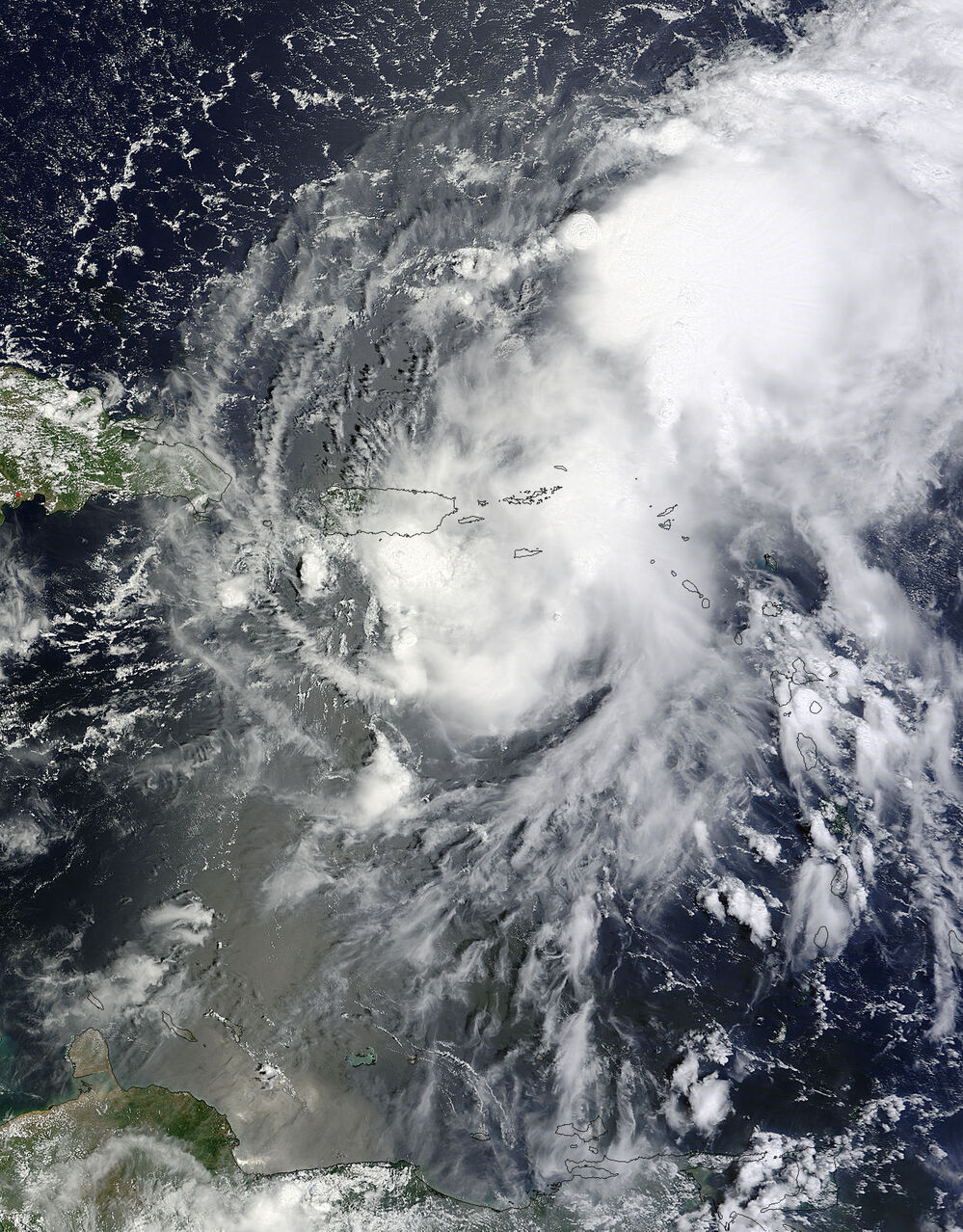 A NASA satellite captured this image of Tropical Storm Gabrielle on Sept. 5 as it was approaching Puerto Rico.NASA
 Scientists took advantage of that range last year while studying an unusual hurricane named Nadine, which spent weeks meandering around the far reaches of the Northeast Atlantic. Nadine was beyond the range of most U.S. aircraft, says Scott Braun, the chief scientist for the NASA mission. But the Global Hawks were able to send back a huge amount of data, he says, as Nadine weakened to a tropical storm and then, surprisingly, began to regain hurricane strength.
"Nadine at that point was over fairly cold water, and the winds were such that the storm should have been getting sheared apart," Braun says. "And yet it survived. So what was scientifically interesting about Nadine was its resilience, despite very adverse surrounding conditions."
Data from the Global Hawks revealed a possible explanation. Even though Nadine had traveled far north, it retained a mass of warm air at its core. That gave it the ability to gather strength again quickly when conditions became more favorable.
This year, scientists are using the Global Hawks to study the Saharan Air Layer, a mass of hot, dry and dusty air that comes off the Sahara every few days. Braun says the Saharan Air Layer interacts with waves of low-pressure air that can turn into hurricanes as they head across the Atlantic.
"Some have argued that the Saharan Air Layer is actually favorable for the growth of those waves and, ultimately, for the development of tropical cyclones because it provides an energy source," Braun says. The energy comes in the form of hot air, which tends to strengthen a hurricane.
But Saharan air is also dry, which tends to weaken a hurricane, Braun says. That dryness has led other scientists to suggest that interaction with the Saharan Air Layer can actually prevent a weather system from becoming a hurricane.
The debate has been hard to settle because it involves weather closer to Africa than the U.S. And that's where the Global Hawks come in handy, Braun says. "It allows us to get to systems at that very early stage when the Saharan Air Layer is most [strongly] interacting with storms," he says.
In recent weeks, the drones have spent much of their flight time investigating tropical storm Gabrielle as it churned up the East Coast. Detailed information about the storm may eventually help scientists understand why some tropical storms quickly intensify into hurricanes while others don't, Braun says.
And the National Hurricane Center has already used data from the Global Hawks to help make forecasts about Gabrielle. That shows how drones could play a valuable role in weather forecasting, says Gary Wick, a scientist with the National Oceanic and Atmospheric Administration.
"I really see the Global Hawk as bridging the gap between aircrafts and satellites," he says, noting that the drones can fly higher than 65,000 feet, yet linger for many hours over a weather system.


