Think about this: You wake up in New York City, decide to go for a stroll, head east after breakfast, and a short time later, still on foot, you find yourself in Morocco. Three hundred million years ago, you could have done that! There was no civilization back then, no cities, no countries, no people, but the land was there, so take a look at this map.
 Courtesy of Massimo Pietrobon
 It pictures the Earth during the late Paleozoic, when all land was clumped into one contiguous mass called the supercontinent Pangea — but in this version they've plopped a modern political details on top, so click the "enlarge" button, and fantasize with me. Start by finding the United States. Then locate New York and you'll see, back then, smooshed up against Long Island was ... Morocco!
I love this map. I found myself taking imaginary walks that made me giggle.
Who wouldn't want to wait for a traffic light in Perth, Australia, cross the street, and suddenly be in Bangladesh? (Yes, you'd have to imagine the traffic light, the street, the people and the wild change in clothes, but the goof is, there'd literally be a spot where the two places met and you could step across it.)
Courtesy of Massimo Pietrobon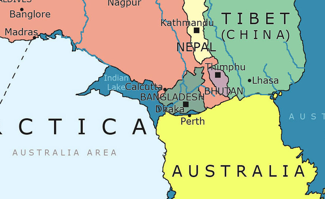
Or: I'm seeing myself on the edge of Mozambique with a beach towel, (today I guess it would be a beach), and I get up, walk a few paces and instead of being in the Indian Ocean — I'm in Antarctica! I know, I know, I wouldn't meet a penguin, not back then, but I'd know that one day there'd be penguins there, so every hike would be a weird cosmic joke. That's my kind of hike.
Courtesy of Massimo Pietrobon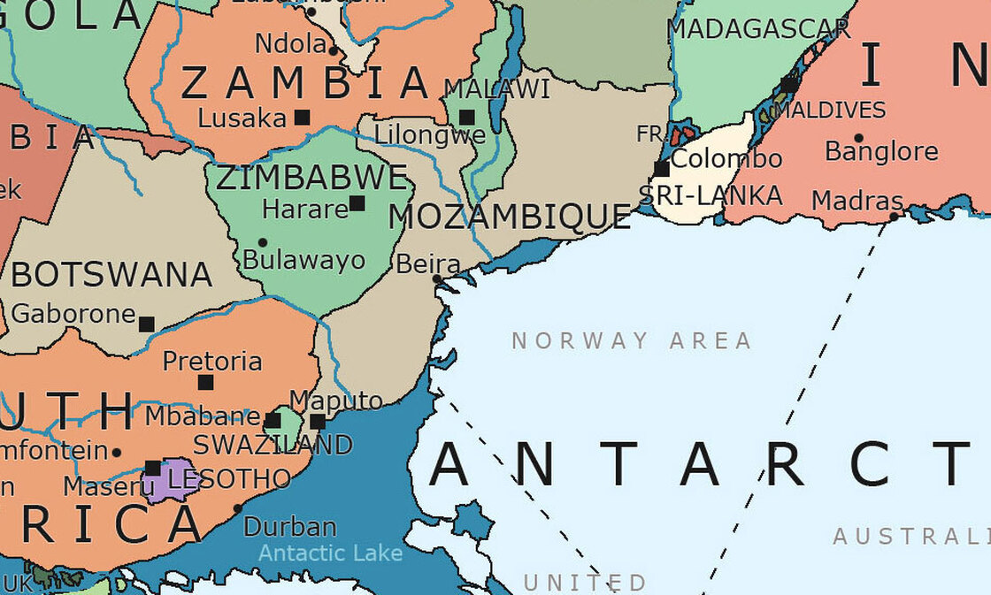
Another fantasy: I'm sitting in Cape Town, South Africa, staring at Argentina just up the block, and watching a trickle of water suddenly appear at the corner. Over the years it widens and widens and widens until it becomes the Atlantic Ocean, and I'm thinking "There goes the neighborhood."
Courtesy of Massimo Pietrobon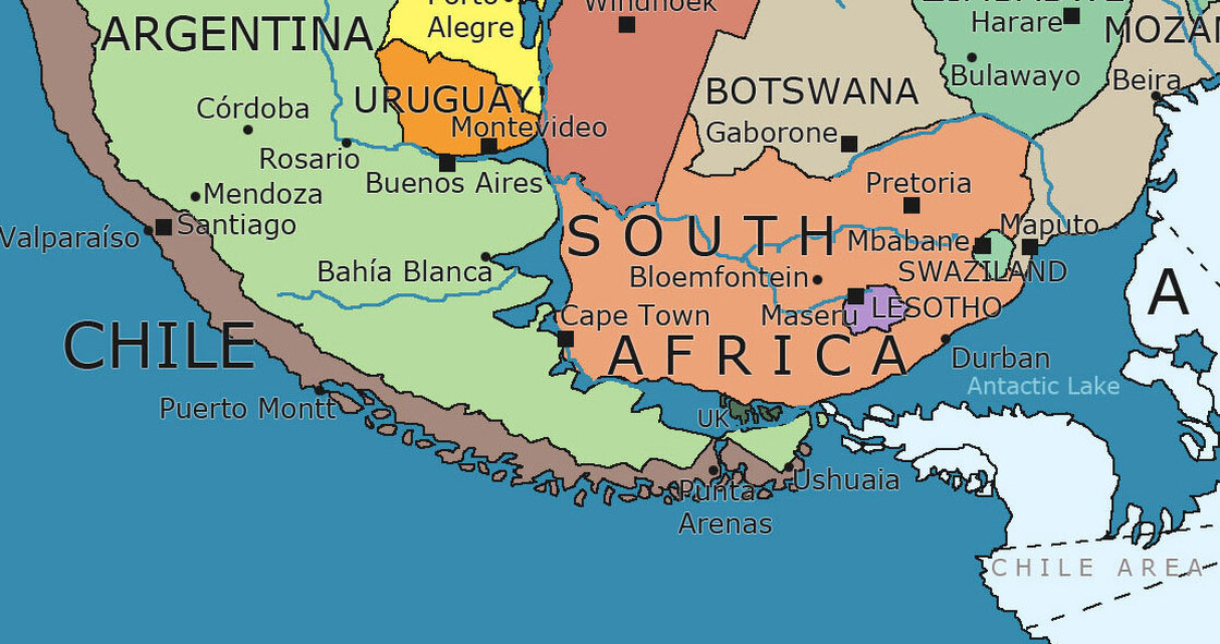
This map has sad and happy surprises. Saddest is Iran. Poor Iran. Back in the day, that country was in three different places, thousands of miles apart. Sort of like Humpty Dumpty. One slice sat along the Persian Gulf. But the capital Tehran, was nowhere near. You'll find it in the upper right, way, way, north, next to an ancient and no-longer-existing ocean. Iran took millions of years to pull itself together.
Courtesy of Massimo Pietrobon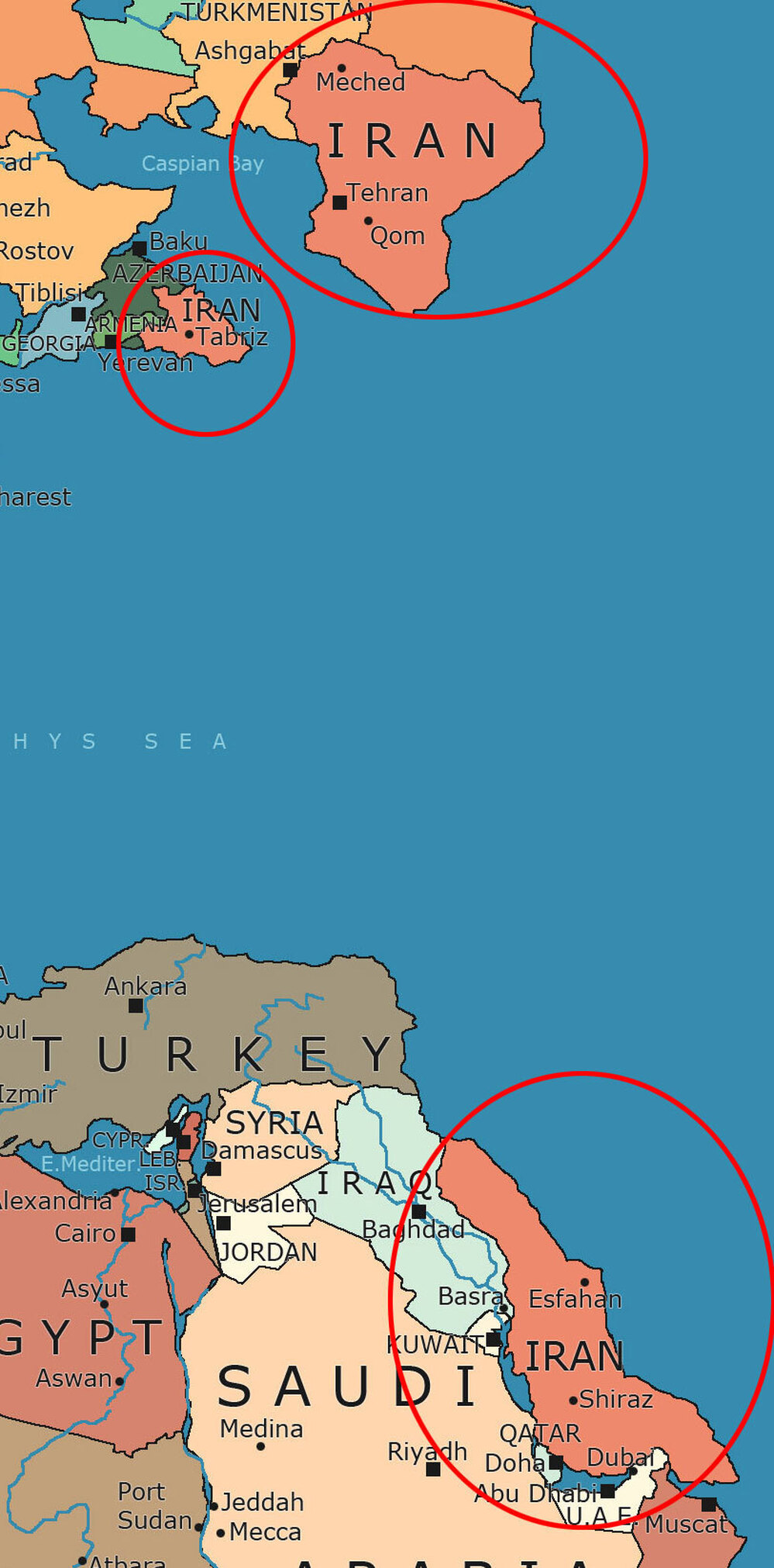 IranCourtesy of Massimo Pietrobon
 But the happy surprise is Florida. Today it's an isolated peninsula, sticking out of the ocean, just above sea level. But back in the Paleozoic, it was the place to be, if you liked company. You'll find it right in the center of this next little map, in green, right next to Conakry, Guinea, where Cuba and Puerto Rico are clumping close, Brazil is a stone's throw south and Sierra Leone a few miles east, so if you run in a big circle, you can play tag with three future continents and a bunch of Caribbean islands on the same day. This is what a good map can do — it can entertain. Who needs Disney World when you can do this?
Courtesy of Massimo Pietrobon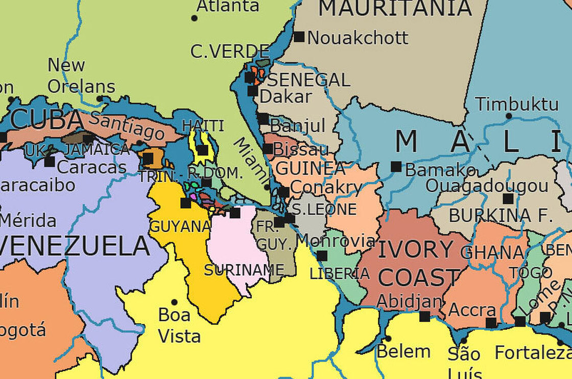
No comments:
Post a Comment